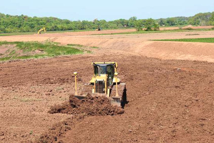
KENTVILLE - Eroding river banks and the threat of rising sea levels from climate change have led to work on a section of dike along the Cornwallis River between Kentville and New Minas.
The $343,000 project, carried out under the National Disaster Mitigation Program, moved a portion of the dike farther away from the river, and topped up that and more of the earthen barrier so the height aligns better with climate change projections. Moving the dike farther away will revert part of the land along the river back to salt marsh, and protect land on the other side that is currently being used for farming.
Kevin Bekkers, the director of resource sustainability with the Nova Scotia Department of Agriculture, said there was an erosion point along the river that the department had been keeping an eye on that had the potential to breach the dike.
“We’re picking a climate change adaptation solution, so it’s involving topping the dikes for climate change but also a bit of a realignment of the dike as well, and that’s given us a better solution,” he said.
He said there were two points where the river was eroding the river bank near the dike, which protects farmland behind it.
“They were small in nature, but we had been monitoring them and they had the potential for failure,” Bekkers said. “Normally we would go in there and patch those under maintenance, but given the sea level rise we tried to create a pilot example there of demonstrating climate change and a realignment of the dike.”
He said the erosion of the bank was from a combination of storm events and the natural flow of the river.
“That’s a significant river flowing both ways with the tide, and then the fresh-water events that come through it. They’re constantly moving.”
He said pushing the dike back creates more room for water should the river overflow its banks and makes it less likely to push against the dike, but also reduces the amount of barrier to be maintained.
“It gives a shorter responsibility (in length) going into the future,” he said. “That was a compromise from the farmer: We would go in and fix it and bring it up for climate change, provided we could take a more strategic approach.”
The dike is about a metre higher than it was before, Bekkers said.
There are about 240 kilometres of dikes in Nova Scotia. Bekkers said they’re not all being raised to the height of this work right now.
“We’re not going to raise all of those overnight, but this was a section that we needed to fix to climate change projections.”
He said raising other sections will be based on prioritizing the areas where work is needed.
The department is assessing other sections of the dikes between Kentville and Wolfville.
“We’re trying to ramp up to do some climate change capital improvements, and get some federal funding,” Bekkers said.