ANNAPOLIS ROYAL, N.S. — Researchers at Fort Anne Historic Site, who used ground-penetrating radar and other modern technologies, have discovered what they believe are the graves of as many as 19 Acadians.
Findings of a Dec. 3, 2018 survey of a 20-by-20-metre section of the Garrison Graveyard were revealed Jan. 30 by MapAnnapolis, Boreas Heritage, and Parks Canada.
Besides the probable graves, technology also showed indications of several roads or paths now invisible to the naked eye, and the existence of a blockhouse that was likely located where the provincial courthouse is now situated.
King’s Theatre was packed with more than 200 people for the big Wednesday afternoon reveal dubbed ‘What Lies Beneath.’ The crowd sat through almost two hours of background, explanations of technology, and finally the results – and they weren’t disappointed.
MapAnnapolis, a project of the Age Advantage Association, had already created an online map of the Garrison Graveyard. But with only a few hundred grave markers visible, and as many as 2,000 graves thought to be in that area of Canada’s first National Historic Site in the country’s oldest European community, there was plenty more to be discovered.
They partnered with Parks Canada, Boreas Heritage of Halifax, the Centre of Geographic Sciences in Lawrencetown, and the Applied Geomatics Research Group at the NSCC in Middleton.
Significance
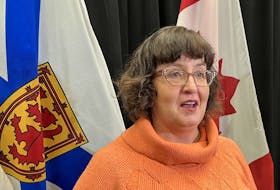
“The significance is obviously that this is an area that has never been researched in any way, and as it was pointed out today, the only way to do that research is to do a dig,” said Heather LeBlanc with MapAnnapolis, “and digs take so long to do.”
She said it’s also contrary to the modern way of doing archeology.
“That’s why this is so important. You saw what was able to be done in half a day that we don’t even know how long it would take if you actually did a dig.”
LeBlanc said the survey and its findings were also significant because they can now start identifying the graves and establish the number of graves.
“It enables us to go and look at Parish records or other maps to see what matches that particular area and then an indication of how we can widen the grid and what else we can find below the surface,” she said.
Sara Beanlands of Boreas Heritage, a full-service archeology consulting company, said it’s important to mention that all of the data they collected was from one day in the field.
“In one day we were able to generate a significant amount of information – a significant amount of new information – but also I guess generate a whole lot more questions than we had when we came,” Beanlands said.
Technology
Steve Garcin, also with Boreas Heritage, and Beanlands explained the technology used, which included GPR, Geographic Information Systems (GIS), unmanned aerial vehicle photography, and light detection and ranging (LIDAR), also done from the air.
GIS is a system designed to capture, store, manipulate, analyze, manage, and present spatial or geographic data, and some of the files used in the Jan. 30 presentation were so large it took several minutes for some of them to load.
LiDAR is a surveying method that measures distance to a target by illuminating the target with a pulsed laser light and measuring the reflected pulses with a sensor, creating a topographical image.
The Applied Geomatics Research Group’s unmanned aerial vehicle used cameras to create some 3-D imaging of the cemetery above ground. The technologies combined created three-dimensional models that are so accurate tape used to mark the GPR grid shows up.
The GPR survey grid was located within the burial ground known by locals as the Saint Jean Baptiste Parish Cemetery with active dates of 1632 to 1755. A monument near the fence on St. George Street notes the cemetery later became the British Garrison Graveyard.
Ted Dolan, Parks Canada's site and visitor experience manager for historic sites in southwestern Nova Scotia, also spoke at the reveal, and said in response to questions that Parks Canada wouldn’t be starting any digs to confirm the GPR findings.
Objective
“If our primary objective was to demonstrate whether or not the GPR could see unmarked burials, then I think we feel quite confident that indeed we were able to,” Beanlands said. “We’ve got at least 19 identified anomalies at a depth of approximately one metre, they’re aligned north-south but oriented east-west. What’s really, really important about these anomalies is the patterning, so that we see that there is a pattern to them,” she said, “which again is very compelling when we’re looking for evidence of burials.”
Beanlands said with the GPR’s abilities proven, it’s a worthwhile endeavour to use the GPR. “It’s an effective way to begin to answer more questions about Fort Anne National Historic Site,” she said, also noting the road to the blockhouse and other unidentified features were observed. “What we would like to do is now continue and extend our grids and get even more data. The more data we have the more patterns we will be able to identify, the more anchor points that we’ll be able to get for geo-referencing.”
She wants to keep adding to what they have.
“The more information we have the more we’ll be able to interpret from it,” she said. “We would like to come back in the very near future, continue to expand our grid, our study area, more GPR survey, see if we can identify what some of these features are that we’re seeing.”
Next Project
“The next project is coming down and doing more of the scan,” said LeBlanc. “Now we can identify the areas that need to be done by the maps that we have by superimposing one map on another. The next thing is to do way more research. We need to be able to tap into all the sources that have information on the area and put them all together. And then, with that, be able to add them to our current map that we have that MapAnnapolis has done at the Garrison Graveyard. So it’s all being able to expand that map to put them on MapAnnapolis web-based map.”
Annapolis Royal’s Mayor Bill MacDonald was at both the Dec. 3 survey and the reveal at King’s Theatre.
“It’s truly remarkable - just one day of data,” he said. “I can only imagine the things that will be uncovered as this project grows and increases in the area that it examines. It’s fascinating they have located the spot of the old blockhouse, which is exciting. This is wonderful, truly wonderful for the area and for archeology.”
The mayor said the findings and the ongoing research makes a visit to Annapolis Royal that much more essential.
“Everybody should have it on their bucket list – Canadians and anybody else that appreciates history and understands this, in fact, is the cradle of our nation,” MacDonald said. “This was the birthplace of Acadie, and to find 19 graves of Acadians in the old burial grounds is a remarkable feat."
A Destination
“I think what they showed today is that technology can really teach us a lot about the past,” said Alan Melanson with the Historical Association of Annapolis Royal. “I was impressed with the explanations they gave. I wasn’t expecting to find bodies but I was expecting to find anomalies and we found that.”
Melanson was impressed with how the technology and survey and interpretations were explained.
“And we also found the blockhouse,” he said. “I knew there was a blockhouse in that corner. That’s a physical structure.”
He said for Acadians the findings will make Annapolis Royal a destination area.
“I can see it happening in the next three or four years,” said Melanson who streamed the presentation by MapAnnapolis and Boreas Heritage. “I had some people from Massachusetts watching. One girl’s in charge of a whole genealogy group. They watched it live while I was taping it, so I think when word gets out about this, the more it gets out, it’s going to make this – the cradle of Acadia, the birthplace of Acadia – a destination area.”
He said he’s very happy.
“I also look forward to the future. More is going to be discovered,” he said. “This is a footprint and there is a whole body of knowledge that’s out there underground, and with the technology of today we’ll be able to find it.”
Exciting
“It’s been a really, really exciting project,” said Beanlands. “We’ve always felt (for) one day in the field I think we have some pretty remarkable results. That being the case, lots of questions, but really it’s given us the opportunity to view Fort Anne, to view the national historic site, to view the history of Annapolis Royal…in a way we’ve never been able to before.”